Great 10 Acre parcel located on county road 428 just off of U.S. Hwy 285. Just pay the doc fee/down payment to get started and we will send you a link to sign the contract online. There is no credit check, no interest on the loan and no pre-payment penalties.
Cash Price: $37,500
Owner Finance: $38,800 – $300 doc fee/$400 down & 96 payments of $424.14 ($400 Loan Payment, $10.00 Service Fee, $14.14 property tax)
• No credit check
• No interest
• No prepayment penalties
Click Here To Finance & Pay Your $700 Doc Fee & Down Payment
Note: Down Payment & Doc Fee can be paid using credit or debit card. Monthly payments must be paid using ACH – checking account/routing number from a bank in the United States.
⚠️ Important: While you can camp and enjoy your property while making payments, permanent residency is not permitted until the land is fully paid off. Weekend camping and recreational use are welcome!
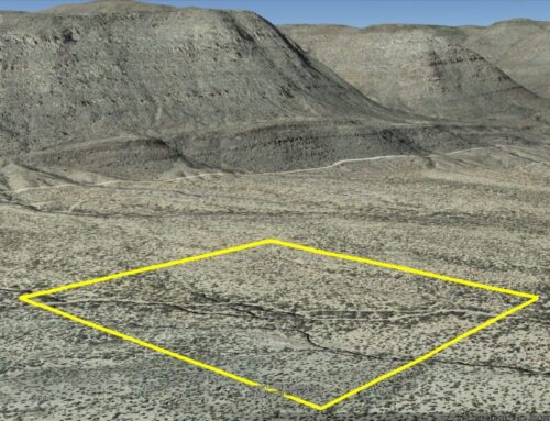
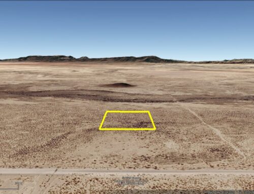
Acres: 10
Property Id: 25328
Legal Description: 10 Acres +/- out of Section 22, Block 2, H& GN RR Co. Survey being the S/2 of Lot 32 of the Sheldon Grossbart Survey, Reeves County, Texas
Note: I do not own the mineral rights
Reeves CAD: https://reeves-cad.org/property-detail/25328
Reeves CAD GIS Map: https://reeves-cad.org/property-detail/25328/2025/gis
Recorded Deed: recorded purch deed 10 Acres Reeves 25328
Elevation: 2780 Ft.
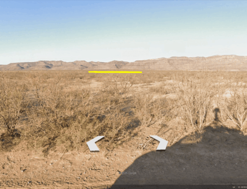
Topography: Flat
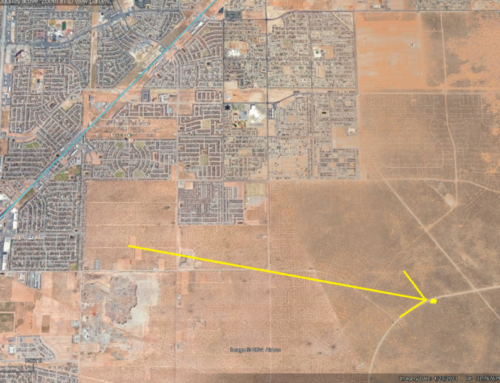
Road: County Road 428
HOA/POA: none
Utilities: Off-Grid, Electric Lines are nearby, but not on the property.
This is off-grid land. There are no city utilities here. You can use batteries, a generator, solar panels or windmill for electricity.
For water you can bring it with you, drill a well, have water trucked in and delivered, set up a rain catchment system
State: Texas
County: Reeves
Property Tax: $169.68
Nearest Town: Pecos, TX
Have Questions? – Read our F.A.Q.s or send us a message or see our testimonials.
Google Map Link: https://maps.app.goo.gl/EUdqf5jz7x3EGiDj8
A phone app such as Land Glide or OnX Hunt can be used to find parcel lines and corners while walking the property (if using OnX Hunt be sure to add the “TX Private Lands” map layer to see the parcel lines).
GPS Coordinates:
NorthWest Corner: 31.668147°,-103.720261°
SouthWest Corner: 31.667431°,-103.720467°
SouthEast Corner: 31.666352°,-103.715295°
NorthEast Corner: 31.667061°,-103.715064°
Area Attractions:
Ready to make this property yours? Have questions? Contact us today to start your journey to land ownership in beautiful West Texas!
CONTACT US
Have Questions? Click Here To Send Us a Message!

Click Here To See Our Customer Testimonials
Click Here To See Our Frequently Asked questions
Who do you know, that’s as awesome as you, that is looking for affordable land?
Share this opportunity with them!
Together, we can make land ownership dreams come true. Thank you! 🌲
![]()