Cash Price: $3,800
Click Here To Pay In Full $3,800
Owner Finance: $3,900 – $300 doc fee/$0 down & 39 payments of $119.12 ($100 Loan Payment, $10.00 Service Fee, $7.60 water district, $1.52 property tax)
• No credit check
• No interest
• No prepayment penalties
Click Here To Finance & Pay Your $300 Doc Fee
Note: Doc Fee can be paid using credit or debit card. Monthly payments must be paid using ACH – checking account/routing number from a bank in the United States.
⚠️ Important: While you can camp and enjoy your property while making payments, permanent residency is not permitted until the land is fully paid off. Weekend camping and recreational use are welcome!
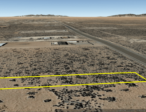
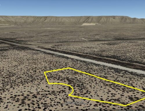
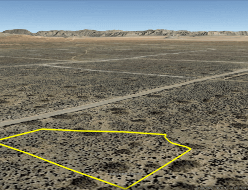
Acres: 0.26
Property Id: R045786
Legal Description: Lot 29 Block 163 Unit 15 TIMBERON SUBDIVISION, Otero County, New Mexico, as shown by the Plat thereof filed in the Office of the County Clerk and Ex-Officio Recorder of Otero County, New Mexico, September 18, 1980; Subject to: Restrictive Covenants and Easements of Record
Property Address: 279 Miles Loop, Cloudcroft, NM 88350
Otero CAD: https://oterocountynm-assessor.tylerhost.net/assessor/taxweb/account.jsp?accountNum=R045786
(CAD site can take up to six months to update after ownership is transferred by recorded deed at county clerk’s office.)
Otero CAD GIS Map: https://oterocountynm-assessor.tylerhost.net/assessor/taxweb/account.jsp?accountNum=R045786&doc=TaxDocument
Recorded Deed: https://countrylandstore.com/wp-content/uploads/2025/09/recorded-purch-deed-ALVARADO-0.26-Acres-Otero-NM-R045786.pdf
Timberon Water & Sanitation District: Timeron Water & Sanitation District information
Elevation: 7,182 ft.
Topography: Sloped
Roads: Dirt
HOA/POA: No POA, however there is a Water & Sanitation district that charges $91.15 per year
Utilities: There is a $1,500 Meter installation fee to connect to the water lines. Electric lines are nearby. There are no public sewer lines here.
State: New Mexico
County: Otero
Property Tax: $18.16 yr.
Nearest Town: Almagordo, NM
Have Questions? – Read our F.A.Q.s or send us a message or see our testimonials.
Google Map Link: https://maps.app.goo.gl/icXgKpU8KHwMgj586
A phone app such as Land Glide or OnX Hunt can be used to find parcel lines and corners while walking the property (if using OnX Hunt be sure to add the “TX Private Lands” map layer to see the parcel lines).
GPS Coordinates:
NorthWest Corner: 32°39’1.01″N,105°41’31.63″W
SouthWest Corner: 32°39’0.13″N,105°41’31.84″W
SouthEast Corner: 32°38’59.88″N,105°41’30.43″W
NorthEast Corner: 32°39’0.77″N,105°41’30.23″W
Area Attractions:
timberon.org
Timberon Golf Course
Community swimming pool
White Sands
Space Museum
Zoo
Grindstone Stables
Alameda Park Zoo
Family Recreation Center
Alamogordo Public Library
Desert Lakes Golf
Ready to make this property yours? Have questions? Contact us today to start your journey to land ownership in beautiful West Texas!
CONTACT US
Have Questions? Click Here To Send Us a Message!

Click Here To See Our Customer Testimonials
Click Here To See Our Frequently Asked questions
Who do you know, that’s as awesome as you, that is looking for affordable land?
Share this opportunity with them!
Together, we can make land ownership dreams come true. Thank you! 🌲
![]()